home / Maps & Prints / Maps / Asia Maps

John Tallis

BACK TO Asia Maps
Next

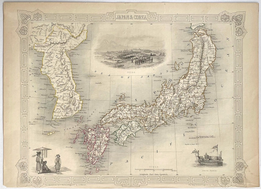
Antique Map - Japan and Corea (1851)

John Tallis

London: Tallis J. & F.
Steel engraving
37.5cm x 27cm
1851
Very Good. Small edge tear at the top and a small area of paper thinning on the reverse which does not affect the front of the map.
X650

Decorative steel engraved map of Japan and the Korean peninsula, surrounded by steel engraved vignette illustrations. Further enhanced with a decorative border design.


Folio, no centrefold.  Size: 37.5cm x 27cm.

75
 

ASK A QUESTION

Antique Map - Japan and Corea

Stock No: X650