
Prev | Next
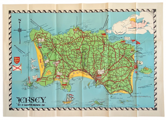
Coloured Pictorial Souvenir Map of Jersey (1948)
F. Mahon-Brown
79cm x 56cm
1948
Near Fine
MX829
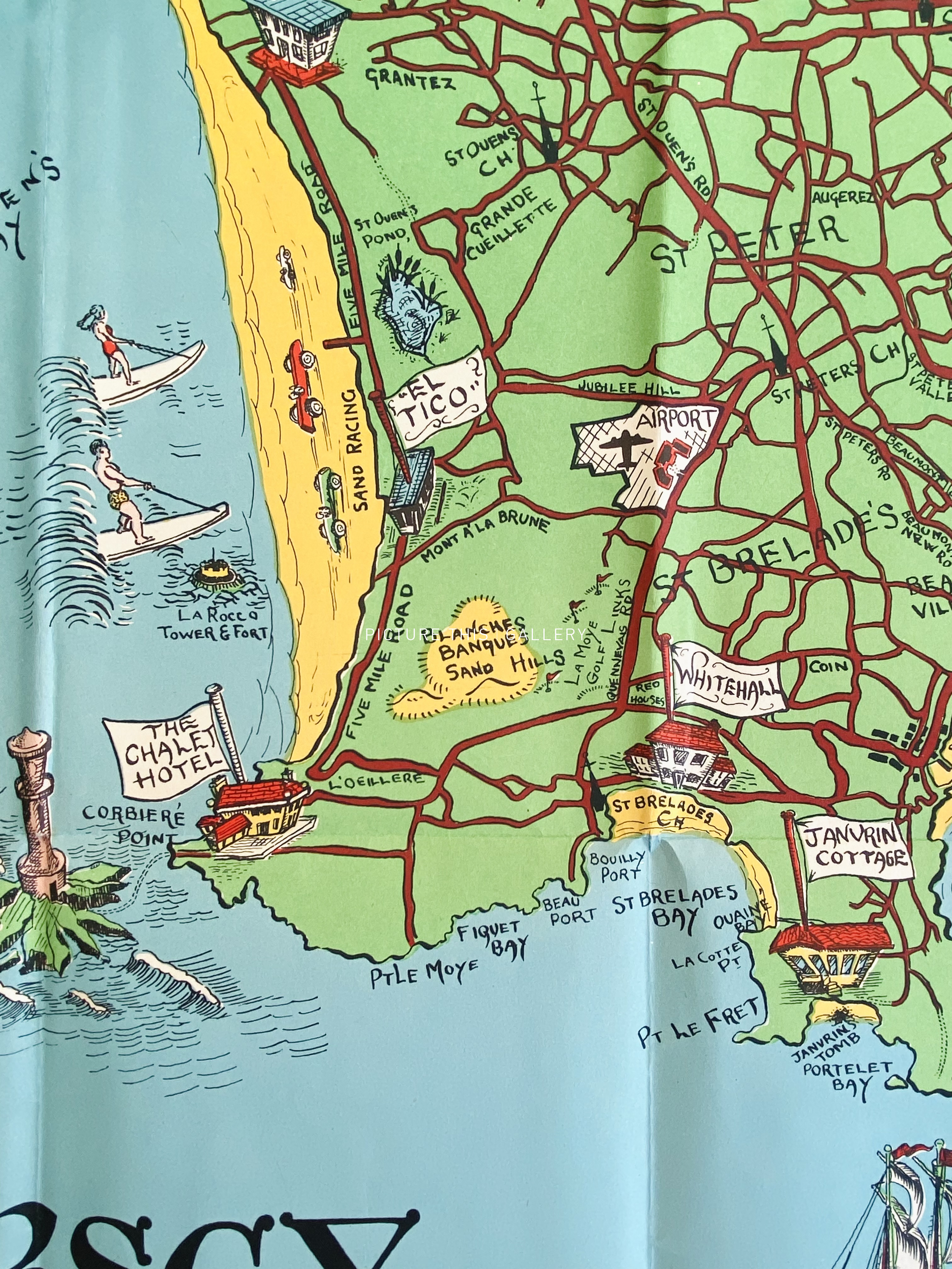
Map of the island of Jersey, 79cm x 56cm, folding into soft card covers. The map is on a scale of 2 inches = 1 mile. There is a small street plan of St. Helier on the outside rear cover.
A decorative map marking points of interest for visitors including hotels, beaches, the airport and other tourist points. In Near Fine condition.
75