Prev | Next
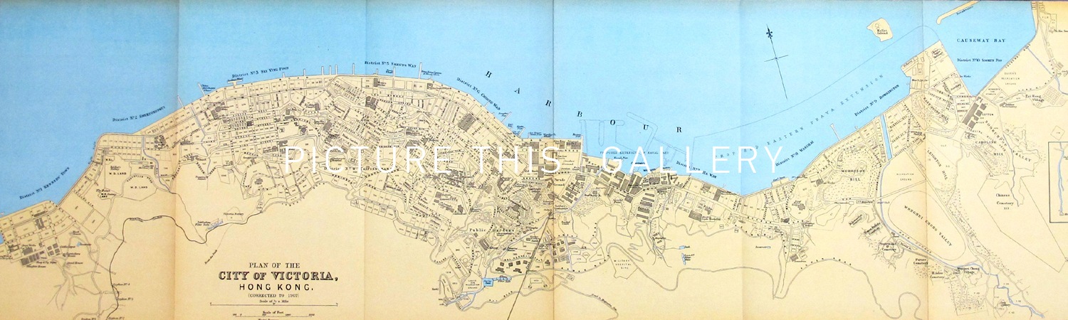
Plan of the City of Victoria, Hong Kong (1907)
John Bartholomew
Lithograph
30" x 8 1/2"
1907
M3618
A detailed lithographic map of the North Shore of Hong Kong Island from Sai Ying Pun to Causeway Bay, issued in 1907. The map identifies roads, major buildings and outlines proposed areas for land reclamation off shore of the Admiralty and Wanchai Districts.